IQ4 embraces google maps with new powerful irrigation mapping
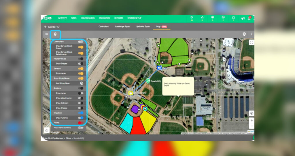
The new Rain Bird Mapping feature for use with the company’s IQ4 Central Irrigation Control Platform embraces the power of Google Maps. It provides highly accurate geomapping of any installation in real time, giving landscape contractors and property managers the ability to manage the system directly on the map by simply clicking on icons of key components. This free tool can be used with any web enabled desktop or mobile device to harness the full range of irrigation monitoring, programming and control features available with IQ4.
An irrigation installation can be precisely geolocated on the Google map by entering a post code. The full site layout is displayed on the user’s device with interactive icons for the controller, master valve and irrigation stations displayed at their exact location. Using colours and characters, the detail and operational status of each component is displayed.
By simply clicking on the controller icon a connection is made to gain quick access to any feature or information including irrigation programs, watering schedules flow alarms and activity logs. Adjustments can then be made to the controller’s settings right on the map. Sync and reverse sync communication between IQ4 and the controller can be instigated to send and receive programs. Clicking an irrigation station icon enables a sprinkler to be immediately started, stopped or adjusted. When an action has been completed, returning directly to the map opens up more management commands and functions.
Programming, monitoring and control functions can be carried out quickly in a highly practical and visual way, without having to navigate through operation menus and commands.The new Mapping feature enables users to take full advantage of IQ4’s remote access to compatible ESP-IVM, ESP-LXD and ESP-LXME controllers without any additional outlay.
For more information, contact Peter Longman, Rain Bird Europe, [email protected] www.rainbird.eu